|
|
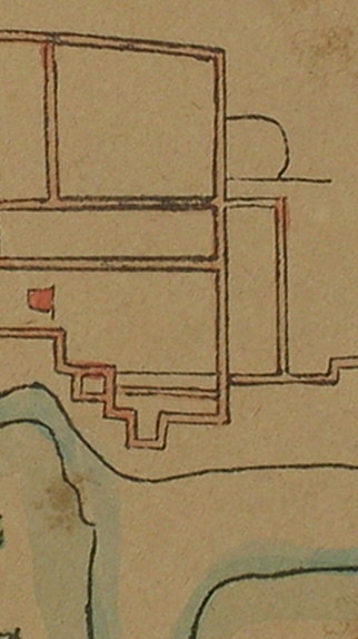
PLAN OF THE ABBEY RUINS IN THE CIVIL WAR
|
|
|
|
The Abbey Ruins in the Civil War from the plan
in the British Library of which there is a copy in the Local Studies
Library. The complex of buildings next to the Kennet resembles that shown
in Coates 1802 map of Reading and the 1834 map of Reading. It is tempting
to see the square of the cloister at the top left, the chapter house
leading off to its right, below the chapter house the slype north of the
dormitory, then the dormitory with its four walls. The rectangular
building below the cloister would of course be the refectory.
From the Local Studies Collection at Reading Central Library - for more images, visit the website - www.readinglibraries.org.uk - and click on "catalogue". |
|
| Back to Short interpretation or Detailed interpretation | |